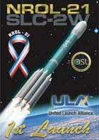
The National Reconnaisance Office, in conjunction with United Launch Alliance, has successfully launched USA 193/NROL-21 into low earth orbit.
USA-193/NROL-21 Launch specifics:
Launch date/time: December 13, 2006 2100 UTC 16:00 EST
Launcher: Delta 2/7920-10
Launch location: Western Test Range, Vandenberg AFB, California
Launch complex/pad: SLC2W
International Designator: 2006-057A
SSC #: 29651
Latest orbital parameters: 376 by 354 km orbit (91.83 minute period), inclined 58.5 degress.
Ted Molczan posted the preliminary orbital elset below on SEESAT-L:
USA 193 0.0 0.0 0.0 4.8 v
1 29651U 06057A 06350.25405986 .00011325 00000-0 10000-3 0 03
2 29651 58.4865 114.2852 0013244 81.7541 278.5044 15.68046894 05
WRMS error = 0.026 deg
Ted noted the following observations in his post:
"The ground track nearly repeats every 2 days (30.92 revs), enabling frequent revisit of observational targets of interest. The first four Lacrosses behaved similarly (28.9 revs in 2 days). Lacrosse 5 makes 43.05 revs in 3 days. Keyholes nearly repeat every 4 days; NOSS every 4 days."
Looking at the early Lacrosse satellite missions, Ted is correct, but, of course, the Lacrosse radar imaging missions are launched into much higher altitude orbits (nearly double the height of NROL-21).
Intl Desig SSC # USA Number Period Inc Apogee Perigee
*1988-106B 19671 USA 034 97.91 56.98 660 657
1991-017A 21147 USA 069 98.00 68.00 667 660
*1997-064A 25017 USA 133 98.22 57.35 674 673 [Replaced Lacrosse 1]
2000-047A 26473 USA 152 98.47 67.99 690 681 [Replaced Lacrosse 2]
*2005-016A 28646 USA 182 99.08 57.01 718 712 [Replaced Lacrosse 3]
* Indicates a 57 degree inclination orbit, just 1.5 degree off the Lacrosse 57 deg inc plane.
As Jonathan McDowell points out in his Jonthan's Space Report Next Issue Draft:
"In contrast to most secret launches, analysts appear to have little clue as to what this payload may be."
My best guess, at this early stage, is that this is probably some sort of mission sensor platform other than a visual photo recon imaging mission. It also could be a new sensor development mission. But that is "only" a best guess!